New worlds
New Worlds presents a selection of five outstanding nautical atlases known as portolan charts, or ''portalans''.These historic documents are the work of eminent scholars from Majorca, Lisbon, Le Havre, and Amsterdam. Cartographers by trade, and sometimes also skilled illuminators, they mapped what was the most probable imago mundi for their time, each exemplar crafting a fascinating visual chronicle. Jean-Yves Sarazin, head of Charts and Maps at the Bibliothèque Nationale de France, scrutinizes thèse charts or atlases, and situates them in the great history of European discoveries and voyages from the early 14th to the late 17th century, from the Portuguese reconnaissance of the coasts of Africa, through the adventures of Columbus,Vespucci, and Magellan, to the Dutch voyages in the Pacific and Australia.The book's many colour reproductions are alive with picturesque details: camel caravans in the heart ofAsia, Portuguese andArab ships sailing in the Indian Ocean, wild beasts or chimaera, countless exotic plants, naval battles, and not least the frequent strangeness of the indigenous people.

| EAN | 9782814400351 |
|---|---|
| Titre | New worlds |
| Auteur | Sarazin Jean-Yves |
| Editeur | BIBLIO IMAGE |
| Largeur | 291 |
| Poids | 610 |
| Date de parution | 20121017 |
| Disponibilité | Sur commande en 6-10 jours |
Pourquoi choisir Molière ?
Du même auteur
-
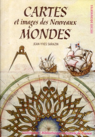
Cartes et images des Nouveaux Mondes
Du XIIIe au XVIIIe siècle, les Européens désireux de commercer avec l'Orient ont tour à tour découvert toutes les parties du globe. Des initiatives individuelles de marchands ou des impulsions de souverains expansionnistes ont permis de mettre en relation toutes les civilisations. Mais de quels instruments cartographiques ces aventuriers des mers disposaient-ils pour partir vers de nouveaux horizons? Ils savaient observer les astres et maniaient la boussole pour fixer le Nord, mais ils ne possédaient aucune carte des continents vers lesquels ils se dirigeaient, aucun tracé des littoraux de terre ferme ou des îles. Tout était à construire.Les premières cartes marines, dites « portulans », apparurent en Occident à la fin du XIII e siècle. Durant cinq siècles, navigateurs et cartographes mirent en commun leur connaissance et leur savoir-faire afin de rendre compte des découvertes. C'est ainsi que ces cartes témoignent des premières reconnaissances d'abord approximatives puis de plus en plus précises qu'ils eurent des Nouveaux Mondes. Par elles, les Européens révèlent leur vision « ethnographique » des sociétés africaines, asiatiques, américaines et océaniennes et attestent de la conquête, de la domination et de la maîtrise des espaces marins et continentaux.EpuiséVOIR PRODUIT8,40 € -
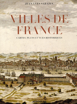
VILLES DE FRANCE
Quoi de mieux pour connaître une ville que de plonger au c'ur de ses artères? Ceux qui rêvent de douceur et de sérénité dans des métropoles dominées par le bruit et la fureur, l'agitation et le tumulte, prendront plaisir à parcourir les images et les textes de ce beau livre sur les villes de France. La vue d'une agréable perspective peut suffire à atténuer la mélancolie: pour s'évader du quotidien, les panoramas urbains ne le cèdent en rien aux paysages champêtres. Le regard emprunte un parcours étonnant depuis la façade atlantique avec la triade Brest, Bordeaux, Nantes; de là, il oblique vers la capitale lorraine Nancy; il poursuit vers la cité du soleil, Montpellier; il remonte d'un trait vers la ville lumière, Paris; puis il se pose tout à tout sur deux métropoles situées sur les marges de la France -l'une au Nord -Strasbourg; l'autre au Sud, Marseille. Au final, l'auteur laisse découvrir l'ancienne capitale des Gaules, Lyon et la ville rose Toulouse. L'écriture de ce livre par un grand spécialiste de l'histoire des cartes s'appuie sur une sélection de documents rares, du XVème siècle à nos jours, de dix grandes métropoles de France parmi des centaines de vues ou de plans manuscrits, gravés et lithographiés qui ont été produits entre 1493 et 1945-bordeaux, Brest, Lyon, Marseille, Montpellier, Nancy, Nantes, Paris, Strasbourg et Toulouse.EpuiséVOIR PRODUIT62,40 € -
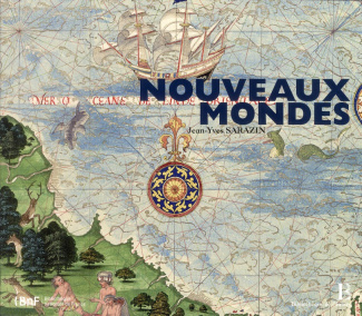
Nouveaux Mondes
Nouveaux Mondes" présente cinq cartes portulans, ou atlas nautiques, choisis pour leur caractère exceptionnel. Ces documents historiques ont été conçus par d'éminents savants originaires de Majorque, de Lisbonne, du Havre et d'Amsterdam. Cartographes de métier, parfois enlumineurs, ils ont su dessiner l'«image du monde» la plus vraisemblable pour leur époque, une chronique visuelle fascinante. Jean-Yves Sarazin, directeur du département des Cartes et Plans de la Bibliothèque nationale de France, examine chacune des cinq cartes / atlas en les situant dans la grande histoire des découvertes et des navigations que menèrent les Européens entre le début du XIVème et la fin du XVIIème siècle, de la reconnaissance des littoraux africains par les Portugais jusqu'aux explorations des îles du Pacifique et de l'Australie par les Hollandais, en passant par les aventures de Colomb, Vespucci et Magellan. Les nombreuses reproductions en couleur permettent d'observer abondance de détails pittoresques: les caravanes de chameaux au c?ur de l'Asie, les navires portugais et arabes croisant dans l'océan Indien, bien des animaux sauvages ou imaginaires, d'innombrables plantes exotiques, des scènes de batailles navales et, bien sûr, l'étrangeté des hommes et des femmes indigènes.EpuiséVOIR PRODUIT10,00 € -
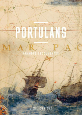
Portulans. Grandes découvertes
Cet opus de "L'Oeil curieux" propose, à travers ces anciennes et très précieuses cartes marines, une traversée des océans à l'époque des grands explorateurs et des grandes découvertes. Portulans Issu de l'italien portolano, le mot "portulan" désigne à l'origine un texte décrivant les côtes, les ports et les conditions de la navigation dans un espace maritime donné. Etendu à la cartographie, le terme a dénommé ensuite un recueil de plans de ports, avant de devenir, dans l'usage courant, une carte marine ancienne. Cartographier l'oce?an Roses des vents, lignes de rhumbs, points cardinaux, îles, ports et littoraux? ces cartes anciennes sont d'incomparables outils pour comprendre et contempler la diversité du monde. Enluminées sur parchemin, souvent rehaussées d'or et minutieusement enrichies de d'évocations pittoresques dues à de vrais artistes, elles constituent aujourd'hui un des fleurons de la Bibliothèque nationale de France. Voyages au long cours Ces trésors de la navigation invitent au voyage et au rêve, dans le sillage de Christophe Colomb, Balboa, Magellan ou Cook. Nouveau Monde, America, Indes occidentales, Terre de Feu, Méditerranée, mers Rouge ou Noire, océans Indien et Pacifique, et même inhospitalier Antarctique? ces mots recèlent une infinie variation de rêves. A l'image de ces cartes marines qui nous disent combien ces explorateurs, héros des temps anciens, ont franchi d'étapes, tracé de routes, osé de choix véritables et de risques majeurs pour nous permettre la découverte d'une altérité et d'un " ailleurs ".Sur commande en 2-4 joursCOMMANDER7,90 €


Du même éditeur
-
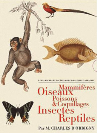
Les Planches du Dictionnaire d'Histoire Naturelle. Coffret 5 volumes : Mammifères ; Oiseaux ; Poisso
En 1849, paraissait le dernier volume du Dictionnaire universel d'histoire naturelle : 16 tomes dont 3 atlas de planches, publiés à Paris par les soins de Messieurs Renard, Martinet et Cie, à l'amusante enseigne de "Au bureau principal de l'éditeur". Entrepris en 1841, « ce vaste panorama des Sciences naturelles » dirigé par Charles d'Orbigny (1806-1876), botaniste et géologue issu d'une famille de scientifiques, allait satisfaire à la fois la curiosité du grand public pour la nature et la science aussi bien que le goût pour l'exhaustivité et l'exactitude des érudits. À la tête d'une prestigieuse et fidèle équipe de rédacteurs dont Arago, Brongniart et Jussieu, Charles d'Orbigny sut également s'entourer d'animaliers de grand renom tels Édouard Traviès et Paul-Louis Oudart ou leur aîné, Jean-Gabriel Prêtre. Leurs dessins, parmi les fleurons de l'art animalier, sublimés par la gravure et le coloriage « exécutés par les premiers artistes en ce genre », participèrent, à coup sûr, à l'éclatante réussite de cette passionnante entreprise. Coffret 5 volumes.Sur commande en 6-10 joursCOMMANDER40,00 € -
-
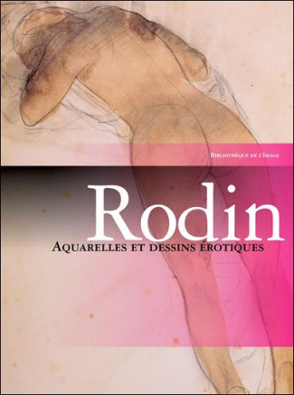
Rodin. Aquarelles et dessins érotiques
55 reproductions (aquarelle et mine de plomb), la plupart en belle page. Photo. 1996, 24 x 32 cm, br., 90 pages.EpuiséVOIR PRODUIT10,00 € -
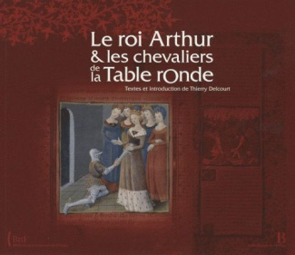
Le roi Arthur et les chevaliers de la Table ronde
Page après page, l’un des plus beaux manuscrits de la Bibliothèque Nationale de France illustre les exploits du meilleur des chevaliers, Lancelot du Lac, depuis le combat victorieux de Lancelot contre les automates de la Douloureuse Garde ou la délivrance des chevaliers du Val sans retour, jusqu’à la bataille de Salisbury, où Arthur, mortellement blessé, fait jeter son épée Excalibur avant d’être emporté par Morgane vers l’île des fées. UNE CO-ÉDITION BIBLIOTHÈQUE NATIONALE DE FRANCE - BIBLIOTHÈQUE DE L’IMAGE À L’OCCASION DE L’EXPOSITION À LA BNF DU 20 OCTOBRE 2009 AU 24 JANVIER 2010 SUR LA LÉGENDE DU ROI ARTHUR. La légende du roi Arthur et des chevaliers de la Table Ronde s’est constituée et développée durant des siècles et le mystère suprême du Saint Graal n’a jamais cessé d’inspirer les plus grands créateurs. Si le nom d’Arthur apparaît dès le VIIème siècle, il faut attendre le XIIème pour que fleurisse le mythe littéraire de ce roi des Bretons – dont rien n’atteste aujourd’hui l’existence réelle – capable de vaincre l’empereur de Rome et d’imposer la foi chrétienne à l’Angleterre. Thierry Delcourt, archiviste-paléographe et docteur ès lettres, conservateur général des bibliothèques, dirige depuis 2006 le département des Manuscrits de la Bibliothèque Nationale de France, après avoir notamment été à la tête de la médiathèque de Troyes – il en a conduit la construction de 1996 à 2006 et y a organisé plusieurs expositions: Splendeurs de la cour de Champagne au temps de Chrétien de Troyes (1998), Bestiaire du Moyen Âge (2004), Trésors enluminés de Troyes (2006)… Membre de la Société internationale arthurienne, Thierry Delcourt a publié de nombreux ouvrages et a participé à plusieurs volumes de l’édition du Roman de Tristan en prose dirigée par Philippe Ménard (Droz, t. II, 1990 et t. V, 1992; Champion, version du ms. français 757, t. II, 1999), ainsi qu’au volume VI de l’édition de la version française du Devisement du monde, de Marco Polo (Droz, 2009). Il est aussi l’auteur d’un Que sais-je? consacré à la Littérature arthurienne (PUF, 2000) et il dirige la publication du catalogue de l’exposition La légende du roi Arthur (BNF / Seuil, 2009). On compte en outre parmi ses publications récentes Trésors enluminés de Troyes (CD Rom, Nouveau Monde éditions, 2005), Les Croisades, la plus grande aventure du Moyen Âge (Nouveau Monde éditions, 2007) et Sébastien Mamerot, Les Passages d’outremer, une chronique des croisades jusqu’en 1462 enluminée par Jean Colombe (Cologne, Taschen,2009).EpuiséVOIR PRODUIT10,00 €


De la même catégorie
-
-

La fuite en Egypte. Dans l'art d'Orient et d'Occident
En dehors de la division de soi-même à cause du péché, de la fondation d'une famille et de l'expérience de la vieillesse, le Christ a tout connu de l'existence humaine ? y compris, à travers l'épisode de la Fuite en Egypte, l'expérience de l'exil et de l'expatriation. Dans cet ouvrage richement illustré, François Boespflug et Emanuela Fogliadini mettent en lumière les raisons de la fécondité insoupçonnée de ce thème iconographique et l'évolution de son traitement au cours des siècles ? du conte merveilleux issu de la tradition des écrits apocryphes à la prise en compte de la réalité cruelle de l'exil, beaucoup plus respectueuse de la réalité de l'Incarnation. Ainsi l'histoire de l'art rejoint-elle l'actualité la plus brûlante, et contribue-t-elle, à sa mesure, à propager un message d'espérance.Sur commande en 2-4 joursCOMMANDER39,00 € -
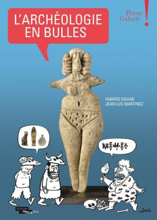
L'archéologie en bulles. Petite Galerie
Comme chaque année, un art vivant est invité à dialoguer avec les ?uvres exposées au sein de la Petite Galerie du musée du Louvre. Cet espace dédié à l'éducation artistique et culturelle est une véritable introduction aux collections du musée. Pour sa quatrième saison, le Louvre convie le neuvième art ? la bande dessinée ?, avec lequel il dispose déjà d'un riche passé à travers ses publications, ses expositions et ses rencontres d'artistes. « Archéologie et bande dessinée » : le sujet a donné lieu à de nombreuses manifestations en France et à l'étranger tant les univers de ces deux disciplines paraissent proches dans l'imaginaire populaire. Préparatifs et départs d'expéditions, émotion de la découverte et fascination pour les trésors émaillent les récits des artistes, des consuls et des savants à la recherche d'antiques civilisations, et forment la trame de bien des scénarios de bandes dessinées. « L'Archéologie en bulles » explore la thématique sous un angle inédit, puisqu'il s'agit de mettre en lumière ces deux disciplines au travers de leurs procédés communs, le travail du bédéiste faisant écho à celui de l'archéologue. Découvrir, classer, interpréter : ces trois moments de la recherche archéologique peuvent ainsi servir de fil conducteur à ce parcours original. Une large variété de planches, d'originaux de bandes dessinées d'auteurs de renom ? Jul, Winsor McCay, Nicolas de Crécy, Enki Bilal, Harold R. Foster, Milo Manara, Emmanuel Guibert, Andreas, Lorenzo Mattotti, François Schuiten, John Buscema, Frank Miller, pour n'en citer que quelques-uns ? dialoguent avec les ?uvres du Louvre et celles d'autres grands musées : dessins choisis dans des carnets, cahiers de fouilles, livres, gravures, peintures illustrant le goût des ruines en vogue au 18 e siècle chez les artistes et au 19 e siècle chez les amateurs qui constituent des collections, comme celle du marquis Campana, sans oublier la figure emblématique de Champollion, le fabuleux trésor de Boscoreale ou encore le site mythique de Suse. À l'origine de nombreuses vocations d'archéologues et source d'inspiration pour bien des créateurs, le Louvre tisse un lien entre inventeurs de trésors et inventeurs d'histoires, prouvant une fois encore qu'il est un acteur de son temps.Sur commande en 2-4 joursCOMMANDER29,00 € -